Estado del Mar Rojo Distritos Referencias Menú de navegación19°03′43″N 35°38′22″E /...
Estados de SudánPuerto Sudán
18 estadosSudán2010Puerto Sudán
| Mar Rojo Al Bahr al Ahmar | ||
|---|---|---|
Estado | ||
 | ||
 | ||
| Coordenadas | 19°03′43″N 35°38′22″E / 19.061944, 35.639444Coordenadas: 19°03′43″N 35°38′22″E / 19.061944, 35.639444 | |
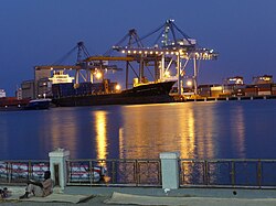
| Capital | Puerto Sudán | |
| Entidad | Estado | |
| • País | ||
| Superficie | ||
| • Total | 218887 km² | |
Población (2010) | ||
| • Total | 1 396 000 hab. | |
| • Densidad | 6,38 hab/km² | |
Mar Rojo (en árabe Al Bahr al Ahmar) es uno de los 18 estados de Sudán. Tiene un área de 218.887 km² y una población estimada de 1.396.000 (2010).[1] Puerto Sudán es la capital del estado.[2]
Distritos
- Bur Sudan (Port Sudan)
- Gebiet Elma'din
- Halayib
- Haya
- Sawakin
- Sinkat
- Gunob Awlieb
- Derodieb
- Tokar
- Ageeg
Referencias
↑ "Red Sea State" on the Republic of Sudan website
↑ www.statoids.com: estados del Sudán

